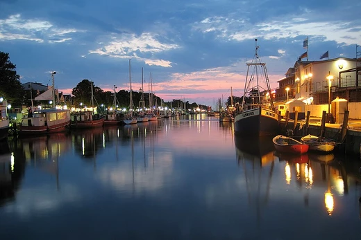
Buckingham Canal

Constructed during British rule, it was an important waterway in the late 19th and early 20th centuries, connecting natural backwaters to the Chennai (Madras) port. Its importance declined due to competition from rail and road transport, and portions became unusable and polluted, though recent interest has focused on its potential for flood protection and restoration.
- Original name
- Cochrane's Canal (renamed Buckingham Canal in 1878)
Verified Timeline
Lore & Background
The canal was renamed the Buckingham Canal in 1878 after the Duke of Buckingham and Chandos, a separate administrative decision. The canal lost importance due to railway competition and its decline continued after the Second World War, never regaining significant commercial importance. The Second Five Year Plan included development of the canal, linking it with Madras harbour. The canal runs about 1 km inland, joining natural backwaters and fed by tidal waters.
Reader's Guide
Its decline due to rail and road competition reflects broader shifts in transportation. The canal remains a complex legacy of colonial infrastructure, environmental challenge, and modern urban planning.
Did You Know?
- The canal was renamed the Buckingham Canal in 1878 after the Duke of Buckingham and Chandos.
- The canal was declared National Waterway 4 in 2008.
Engineering Marvel and Water Management
The Panama Canal stretches 82 kilometers across the narrowest stretch of the Isthmus of Panama, linking the Caribbean Sea to the Pacific Ocean. Rather than relying on a simple cut through the land, the waterway employs a lock system at both ends to raise vessels up to Gatun Lake, an artificial freshwater body sitting 26 meters above sea level. This lake was formed by damming the Chagres River and Lake Alajuela, a design choice that dramatically cut the volume of excavation needed. The original lock chambers measure 33.5 meters in width and accommodate so-called Panamax-class ships. To handle larger modern vessels, a third, wider set of locks was built between September 2007 and May 2016, entering commercial service on 26 June 2016 and enabling Neopanamax-class transit. Each single ship passage consumes roughly 200 million litres of fresh water, a fact that makes the canal vulnerable during periods of drought when water levels drop. The American Society of Civil Engineers has recognized the project as one of the Seven Wonders of the Modern World.
A Century of Shifting Sovereignty
The territory surrounding the canal passed through the hands of several nations over more than a century. France launched construction in 1881 but abandoned the effort by 1889, citing engineering difficulties, a high death toll among workers, and a collapse in investor confidence. The United States assumed control of the project in 1904 and completed the canal, which opened on 15 August 1914. American authority over the canal and the surrounding Panama Canal Zone continued until the Torrijos–Carter Treaties of 1977 set the stage for a transfer. After a transitional phase of joint American–Panamanian management, full sovereignty passed to the Panamanian government in 1999. Today the waterway is administered by the Panama Canal Authority, a government-owned body. Colombia also held influence over the region during earlier phases of the project's history. The layered succession of colonial, corporate, and national control makes the canal's political story as complex as its engineering one.
Reshaping Global Commerce
By offering a direct shortcut between the Atlantic and Pacific Oceans, the canal spares vessels the long and dangerous voyage around the southern tip of South America via the Drake Passage, the Strait of Magellan, or the Beagle Channel. Since its 1914 inauguration, this shorter and comparatively affordable transit route has decisively altered global trade patterns, stimulating economic growth in both developed and developing nations and serving as a catalyst for expansion in remote parts of the world. The volume of traffic tells the story of that transformation: roughly 1,000 ships transited in the opening year, whereas by 2008 the figure had climbed to 14,702 vessels carrying 333.7 million PC/UMS tons. Cumulative passage surpassed 815,000 vessels by 2012, with the United States, China, Chile, Japan, and South Korea leading usage. In 2017 the average transit between the two outer locks took 11.38 hours. The American Society of Civil Engineers has listed the canal among the Seven Wonders of the Modern World, a testament to its enduring commercial significance.
From Balboa's Journal to the Gold Rush
The dream of a trans-Isthmian waterway stretches back to 1513, when Vasco Núñez de Balboa first crossed the Isthmus of Panama and noted in his journal the possibility of a canal, though he took no further action. In 1534 Holy Roman Emperor Charles V ordered a survey to ease the Spain-to-Peru voyage, and in 1668 the English physician Sir Thomas Browne singled out Panama as the most convenient site. Scotland's ill-fated Darien scheme of 1698–1700 attempted a trade colony at the isthmus but was abandoned under harsh conditions. In 1811 Alexander von Humboldt evaluated five Central American routes and favored Nicaragua, a recommendation that prompted a British canal attempt in 1843 which ultimately failed and led to the Clayton–Bulwer Treaty of 1850. The 1848 California gold discovery created urgent demand for a Pacific crossing. American businessman William Henry Aspinwall exploited this with steamship legs and an overland portage, and between 1850 and 1855 a syndicate built a railroad from Colón to Panama City at a cost of eight million dollars—six times the estimate—claiming between 6,000 and 12,000 workers' lives to tropical disease.
Frequently Asked Questions
What is the Buckingham Canal?
It is a brackish-water canal running along the Coromandel Coast of South India, stretching from the Krishna River delta in Andhra Pradesh down to Marakkanam in Tamil Nadu. Built during the British colonial era, it once linked a chain of natural backwaters to the port of Madras (now Chennai).
What was the Buckingham Canal originally called?
The waterway first went by the name Cochrane's Canal after its initial segment was completed in 1806. It was only renamed the Buckingham Canal in 1878, roughly seventy years after construction of that first stretch began.
Why did the Buckingham Canal fall out of use?
The rise of railway and road networks in the late 19th and early 20th centuries steadily eroded the canal's role as a freight and passenger link. Over time, sections silted up, became polluted, and were no longer navigable.
Where exactly does the Buckingham Canal run?
The canal traces a path roughly parallel to the Coromandel Coast, beginning at Gudivada Kalava on the Krishna River in Andhra Pradesh and ending at Marakkanam in Tamil Nadu. It was designed to connect the natural backwater system of the delta to the port at Madras.
Is there any plan to restore the Buckingham Canal?
Recent discussions have centered on redeveloping the waterway as a flood-protection measure for the Chennai region. While large stretches remain degraded, there is renewed interest in cleaning and reviving portions of the canal for both ecological and practical purposes.
More in Canals And Artificial Waterways 1-19
Spotted an error? Know more?
This is a living reference — every entry is fact-audited, and reader corrections feed straight into our audit queue. Suggest an edit · See this site's audit record