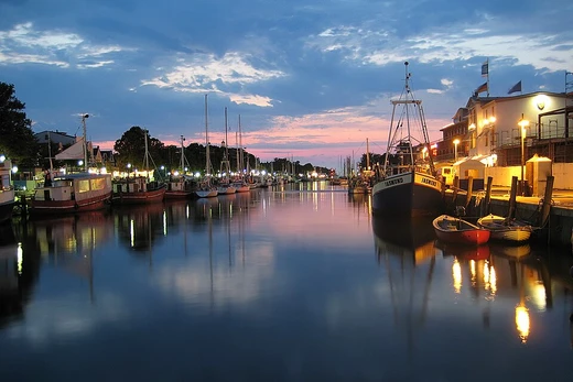
Caledonian Canal
Scottish canal linking east and west coasts via the Great Glen.

The Caledonian Canal is a waterway in Scotland that connects the east coast at Inverness with the west coast at Corpach near Fort William. Constructed in the early nineteenth century by Scottish engineer Thomas Telford, the canal runs roughly 60 miles (100 kilometres) from northeast to southwest, reaching 106 feet (32 metres) above sea level. Only about one third of its length is man-made, the remainder being formed by Loch Dochfour, Loch Ness, Loch Oich, and Loch Lochy, which lie in the Great Glen along a geological fault.
- constructed
- early nineteenth century
- engineer
- Thomas Telford
- length
- 60 miles (100 kilometres)
- max_elevation
- 106 feet (32 metres) above sea level
- locks
- 29
- aqueducts
- 4
- bridges
- 10
Verified Timeline
Lore & Background
The canal begins at its north-eastern end at Clachnaharry Sea Lock, built at the end of a man-made peninsula to ensure boats could always reach deep water in the Beauly Firth. Because the peninsula has mud foundations, it has required regular maintenance ever since. Nearby, a swing bridge carries the Far North railway line across the canal; the first bridge at the site was designed by Joseph Mitchell in 1862 and replaced by a steel structure in 1909. The canal passes through Muirtown Basin, under a swing bridge carrying the A862 road, and through a flight of four Muirtown Locks. From there it continues south to Tomnahurich swing bridge, where the original timber bridge was replaced by a steel structure in 1938. A second swing bridge opened in June 2021 as part of the Inverness West Link project, allowing traffic to be diverted while one bridge is open for canal traffic.
Reader's Guide
The Caledonian Canal remains a significant feat of early nineteenth-century engineering, demonstrating Thomas Telford's ability to link natural lochs with man-made channels and locks across the Great Glen. Its 29 locks, including the eight at Neptune's Staircase, and four aqueducts allowed vessels to traverse the 106-foot elevation change. The canal's construction and subsequent modifications—such as the addition of a lock at Gairlochy in 1844 and the deepening of the Bona channel in 1844—reflect ongoing efforts to improve navigation. Today, the canal is used for both commercial and recreational boating, and many of its structures, including locks, bridges, and lock keepers' cottages, are listed or scheduled as historic monuments. The canal's water supply, drawn largely from Loch Oich, requires 41.2 million imperial gallons daily to maintain operation.
Did You Know?
- Only about one third of the canal's 60-mile length is man-made; the rest is formed by Loch Dochfour, Loch Ness, Loch Oich, and Loch Lochy.
- The canal reaches 106 feet (32 metres) above sea level at Loch Oich, which is the summit of the canal.
- Neptune's Staircase at Banavie is a flight of eight locks that drops the canal level by 64 feet (20 metres) in just 500 yards (460 metres).
- The canal requires 41.2 million imperial gallons (187 Ml) of water each day to keep operating, most of which comes from Loch Oich.
- Bona Lighthouse, built by Thomas Telford in 1815 as a house and converted around 1848, is a rare example of an inland light.
Engineering Vision & Route Design
Thomas Telford's early-nineteenth-century masterwork stretches roughly sixty miles from Inverness on Scotland's east coast to Corpach near Fort William on the west, running in a northeast-to-southwest direction and climbing to an elevation of 106 feet above sea level. What makes the canal's design remarkable is that only about a third of its total length was actually cut by human hands. The remaining two-thirds are carried by four great lochs—Loch Dochfour, Loch Ness, Loch Oich, and Loch Lochy—which sit within the Great Glen, a deep geological fault in the Earth's crust. Telford essentially borrowed the landscape's own waterways and stitched them together with engineered links. The full route incorporates twenty-nine locks, including the celebrated eight-lock flight known as Neptune's Staircase at Banavie, along with four aqueducts and ten bridges. This hybrid of natural water and artificial channel created a continuous navigable waterway across the heart of the Scottish Highlands, a feat that stood among the most ambitious inland waterway projects of its era.
The Northern Gateway & Industrial Heritage
The canal's northeastern terminus at Clachnaharry was a carefully engineered solution to a practical problem: ensuring vessels could always access the deep water of the Beauly Firth. Telford's team built the sea lock at the tip of a man-made peninsula, though its mud foundations have demanded ongoing maintenance since construction. The adjacent lock-keeper's house, a two-storey building with a single-storey bothy, was later split into two units; by 2005 the eastern half housed Scottish Canals offices, and the whole structure now carries a category C listing. Opposite the lock, a swing bridge carries the Far North railway line. The original wrought-iron span, designed by Joseph Mitchell in 1862, was replaced in 1909 by a 123-foot steel structure, and the nearby 1890 signal box by Mackenzie and Holland together hold category B status. Nearby, a smiddy and workshops dating from the canal's 1810 construction—extended in the 1840s and 1850s—still retain two forging hearths, a tangible link to the canal's industrial origins.
Fort Augustus & the Middle Passage
Where the canal departs the west shore of Loch Ness, it threads between the River Oich to the north and the River Tarff to the south, arriving at the village of Fort Augustus. Here, five locks climb through the centre of the settlement, and the A82 road crosses the waterway on a swing bridge at their base. A railway bridge nearby was built for a planned Fort Augustus-to-Inverness line that operated only briefly from 1903 to 1906 before the project was shelved; surviving piers over the River Oich now stand in poor repair. Further along, Kyltra Lock and its approach canal are protected as scheduled monuments. At Cullochy Lock, a cluster of period buildings survives: a single-storey cottage on the west bank from the canal's original construction, a pair of two-storey lock-keeper houses from around 1830 on the east bank, and a three-bay storehouse from roughly 1815 to 1820 that once held both a store and the keeper's office. The modern Aberchalder swing bridge carries the A82 over the canal, while a Telford-designed cottage nearby once sheltered the bridge keeper.
Preservation & Living Heritage
Much of the Caledonian Canal's physical fabric is now under formal protection. The stretch from Muirtown Locks to Dochgarroch Lock, the lock itself, and the final canal section to Loch Dochfour are all designated scheduled monuments. Dochgarroch Lock was specifically engineered to shield the waterway from flooding caused by the River Ness, whose fluctuating levels are managed by a weir to the south. At the canal's northernmost point, Bona Lighthouse stands as a rare example of an inland light: originally built by Telford in 1815 as a house, it was converted around 1848 after the Bona channel was deepened and widened to accommodate steam tugs replacing horse-drawn barges. Traces of four stables inside the octagonal, two-storey building confirm that earlier function. Lock-keeper's cottages from the 1820s and 1850s have been repurposed over the decades—some into self-catering accommodation, others into offices—while the 2021 opening of a second swing bridge at Tomnahurich, part of the Inverness West Link project, shows the canal still adapting to modern traffic demands.
Frequently Asked Questions
What is the Caledonian Canal and where does it run?
The Caledonian Canal is a Scottish waterway that connects Inverness on the east coast to Corpach near Fort William on the west coast. It stretches roughly 60 miles (100 km) in a northeast-to-southwest direction through the Great Glen.
Who designed and built the Caledonian Canal?
Scottish engineer Thomas Telford was responsible for the canal's design and construction in the early nineteenth century.
How much of the Caledonian Canal is actually man-made?
Only about one third of the total route was artificially excavated. The remaining two thirds consist of natural lochs—Loch Dochfour, Loch Ness, Loch Oich, and Loch Lochy—situated along a geological fault in the Great Glen.
How many locks and aqueducts does the Caledonian Canal feature?
The canal includes 29 locks and 4 aqueducts along its length. At its highest point the waterway reaches 106 feet (32 metres) above sea level.
Why is the Caledonian Canal considered a notable engineering achievement?
It provided a navigable link between the Atlantic and North Sea coasts by threading through existing glacial lochs rather than excavating the entire route. This approach of working with natural geography made it a landmark project of early-1800s Scottish engineering.
More in Canals And Artificial Waterways 1-19
Spotted an error? Know more?
This is a living reference — every entry is fact-audited, and reader corrections feed straight into our audit queue. Suggest an edit · See this site's audit record