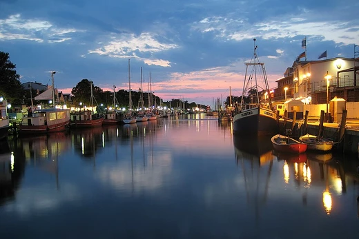
Cape Cod Canal
Artificial waterway connecting Cape Cod Bay and Buzzards Bay.

The Cape Cod Canal is an artificial waterway in Massachusetts connecting Cape Cod Bay in the north to Buzzards Bay in the south, and is part of the Atlantic Intracoastal Waterway. The approximately 7.4-mile-long (11.9 km) canal traverses the neck of land joining Cape Cod to the state's mainland. It mostly follows tidal rivers widened to 480 feet (150 m) and deepened to 32 feet (9.8 m) at mean low water, shaving up to 135 miles (217 km) off the journey around the cape for its approximately 14,000 annual users. The waterway is maintained by the United States Army Corps of Engineers and has no toll fees.
- length
- approximately 7.4 miles (11.9 km)
- width
- 480 feet (150 m)
- depth
- 32 feet (9.8 m) at mean low water
- current speed
- up to 5.2 miles per hour (8.4 km/h) during ebb tide
- annual users
- approximately 14,000
- construction began
- first excavation in 1880; successful private construction began June 22, 1909
- opened
- limited basis July 29, 1914; completed 1916
Verified Timeline
Lore & Background
The idea of a canal was first considered by Myles Standish of the Plymouth Colony in 1623, and the Pilgrims scouted the low-lying stretch of land between the Manomet and Scusset rivers for potential routes. William Bradford established the Aptucxet Trading Post in 1627 at the portage between the rivers. In 1697, the General Court of Massachusetts considered the first formal proposal to build the canal but took no action. A separate canal called Jeremiah's Gutter was created in Orleans in 1717 and remained active only until the late 1800s. Surveys were commissioned repeatedly in 1776 (by George Washington), 1791, 1803, 1818, 1824–1830, and 1860, but none led to construction. Actual building began in 1880 when the Cape Cod Ship Canal Company hired 400 immigrant Italian laborers to dig with shovels and wheelbarrows, but the effort ran out of money almost immediately and the laborers were unpaid and forced to beg for food in Sandwich. A reorganization under engineer Frederick Lockwood used a bucket dredge to clear nearly a mile of channel through the Sandwich marshes before shutting down in 1891. Successful private construction started on June 22, 1909 under August Belmont Jr.'s Boston, Cape Cod & New York Canal Company, using designs by engineer William Barclay Parsons. The canal opened on a limited basis on July 29, 1914 and was completed in 1916 as a privately owned toll canal with a maximum width of 100 feet (30 m) and a maximum depth of 25 feet (7.6 m). On July 25, 1918, the Director General of the United States Railroad Administration took over jurisdiction and operation of the canal under a presidential proclamation, four days after the German U-boat U-156 surfaced three miles off Orleans and shelled the tugboat Perth Amboy and her string of four barges. The government purchased the canal in 1928 for $11.4 million as a free public waterway, and $21 million was spent between 1935 and 1940 increasing the canal's width to 480 feet (150 m) and its depth to 32 feet (9.8 m), making it the widest sea-level canal of its time. During World War II, shipping again used the canal to avoid U-boats patrolling offshore, and it was protected by coastal artillery batteries at the Sagamore Hill Military Reservation and the Butler Point Military Reservation, though the artillery was never fired in defense of the canal.
Reader's Guide
The Cape Cod Canal holds significance as a major maritime shortcut that reduced the sea route between New York City and Boston by 62 miles (100 km), and as a key component of the Atlantic Intracoastal Waterway. Its construction overcame decades of failed attempts, financial difficulties, and engineering challenges including large submerged boulders and cold winter storms. The canal's expansion in the 1930s, informed by a large scale model built by the Massachusetts Institute of Technology (9 feet to a mile, roughly 1⁄587 actual size) to study tidal currents, made it the widest sea-level canal of its time. During both World Wars, the canal provided a protected route for shipping, avoiding submarine threats offshore. Today, it serves approximately 14,000 annual users, including recreational and commercial vessels, and is maintained toll-free by the United States Army Corps of Engineers. The canal also supports recreational activities such as fishing, bicycling, and walking along its service roads, and is occasionally used by whales and dolphins, including endangered North Atlantic right whales, which can cause closure of the canal. A popular folklore about a fictitious road tunnel under the canal emerged in the late 20th century, with souvenir 'permits' sold since 1994; in 2019, MassDOT said it had studied the idea but had no plans to build it.
Did You Know?
- The canal shaves up to 135 miles (217 km) off the journey around Cape Cod for its approximately 14,000 annual users.
- A swift-running current changes direction every six hours and can reach 5.2 miles per hour (8.4 km/h) during the receding ebb tide.
- The canal is occasionally used by endangered North Atlantic right whales, which can cause closure of the canal.
- During World War II, the collier SS Stephen R. Jones grounded and sank in the canal on June 28, 1942, and was removed with the help of 17 tons of dynamite.
- A popular folklore about a fictitious road tunnel under the canal emerged in the late 20th century, with souvenir 'permits' sold since 1994.
A Century of Failed Ambitions
The dream of cutting a shortcut through Cape Cod's narrow neck stretches back to the earliest days of English settlement. In 1623, Myles Standish of the Plymouth Colony first considered the idea, and the Pilgrims scouted the low-lying stretch of land between the Manomet and Scusset rivers for potential routes. William Bradford established the Aptucxet Trading Post in 1627 at the portage between the rivers, where trade prospered with the Indians of Narragansett Bay and the Dutch of New Netherland, a major factor enabling the Pilgrims to pay off their debt. The General Court of Massachusetts considered the first formal proposal in 1697 but took no action. A narrower waterway called Jeremiah's Gutter was created in Orleans in 1717 and remained active only until the late 1800s. Surveys were commissioned repeatedly in 1776 (by George Washington), 1791, 1803, 1818, 1824–1830, and 1860—none yielded a finished canal. The first real digging arrived in 1880, when the Cape Cod Ship Canal Company hired 400 immigrant Italian laborers to excavate with shovels and wheelbarrows. Funds collapsed almost immediately; the workers went unpaid and were forced to beg for food in Sandwich. A reorganization in 1883 under engineer Frederick Lockwood brought a bucket dredge that cleared nearly a mile of channel through the Sandwich marshes before the project shut down in 1891.
The Private Canal and Its Struggles
On June 22, 1909, a working canal finally began taking shape under the Boston, Cape Cod & New York Canal Company, backed by August Belmont Jr. and designed by engineer William Barclay Parsons. The crew faced formidable obstacles: large submerged boulders required divers to blow them up with explosives, slowing dredging considerably, and cold winter storms forced the engineers to stop dredging altogether and wait for spring. Despite these setbacks, the canal opened on a limited basis on July 29, 1914, and was fully completed in 1916. The privately owned waterway had a maximum width of 100 feet (30 m) and a maximum depth of 25 feet (7.6 m), and it took a somewhat difficult route from Phinney Harbor at the head of Buzzards Bay. The narrow channel proved hazardous; several accidents occurred due to the narrow channel and navigation difficulty, limiting traffic and tarnishing the canal's reputation. Toll revenues failed to meet investors' expectations as a result, despite shortening the trade route from New York City to Boston by 62 miles (100 km). The private era's struggles ultimately set the stage for government intervention and a far more ambitious public project.
Becoming a Public Engineering Marvel
The canal's transformation into a public engineering marvel began on July 25, 1918, when the Director General of the United States Railroad Administration took over jurisdiction and operation under a presidential proclamation—just days after the German U-boat U-156 surfaced three miles off Orleans on July 21, 1918 and shelled the tugboat Perth Amboy and her string of four barges. The Army Corps of Engineers re-dredged the channel to 25 feet (7.6 m) deep during the government's interim control until 1920. In 1928, the federal government purchased the waterway for $11.4 million, converting it into a free public waterway. Between 1935 and 1940, an additional $21 million was spent increasing the canal's width to 480 feet (150 m) and its depth to 32 feet (9.8 m), making it the widest sea-level canal of its time. The southern entrance to the canal was rebuilt for direct access from Buzzards Bay rather than through Phinney Harbor. Before construction began, the Massachusetts Institute of Technology built a huge scale model of the canal (9 feet to a mile, roughly 1⁄587 actual size) to study the hydraulic effects of tidal currents on the enlarged and rerouted canal. Today the Army Corps of Engineers maintains the waterway, which carries no toll fees and serves roughly 14,000 annual users, cutting as much as 135 miles (217 km) from the trip around the cape.
War, Wrecks, and Whale Encounters
World War II brought renewed urgency to the canal as merchant shipping used it to avoid U-boats patrolling offshore. Coastal artillery batteries at the Sagamore Hill Military Reservation (north entrance) and the Butler Point Military Reservation (south entrance) guarded the waterway, though the artillery was never fired in defense of the canal. In June 1942, the Mystic Steamship Company's collier SS Stephen R. Jones grounded and sank in the canal on June 28, forcing shipping to be routed around Cape Cod. The vulnerability was confirmed on July 3 when the Liberty ship SS Alexander Macomb was torpedoed by the German submarine U-215 with the loss of ten lives. The canal reopened on July 31 after the wrecked Stephen R. Jones was removed with the help of 17 tons of dynamite. In the modern era, the canal serves as a vital link in the Atlantic Intracoastal Waterway, traversing mostly the town of Bourne with its northeastern terminus in Sandwich. A swift tidal current changes direction every six hours and can reach 5.2 miles per hour (8.4 km/h) during the receding ebb tide. The waterway is spanned by the Cape Cod Canal Railroad Bridge, the Bourne Bridge, and the Sagamore Bridge, with traffic lights at either end governing the approach of vessels over 65 feet (20 m). Perhaps most strikingly, the canal is occasionally used by whales and dolphins, including endangered North Atlantic right whales, which can cause closure of the canal.
Frequently Asked Questions
What is the Cape Cod Canal and where is it located?
It is a man-made waterway in Massachusetts that cuts through the narrow neck of land connecting Cape Cod to the state's mainland. The canal links Cape Cod Bay on one side with Buzzards Bay on the other and functions as a segment of the Atlantic Intracoastal Waterway.
How long is the Cape Cod Canal and what are its dimensions?
The waterway stretches roughly 7.4 miles (about 11.9 km) in length, is 480 feet wide, and reaches a depth of 32 feet at mean low water. During ebb tide, the current can push vessels at speeds up to about 5.2 miles per hour.
How much distance does the Cape Cod Canal save for mariners?
By providing a direct crossing, the canal trims up to 135 miles off a trip that would otherwise require rounding the entire cape. Approximately 14,000 vessels take advantage of this shortcut each year.
Who maintains the Cape Cod Canal and is there a toll?
The United States Army Corps of Engineers is responsible for keeping the canal in navigable condition. No toll fees are charged to vessels passing through.
When was the Cape Cod Canal built?
The very first excavation work dates back to 1880, but the project that ultimately succeeded as a private construction effort did not begin until June 22, 1909.
More in Canals And Artificial Waterways 1-19
Spotted an error? Know more?
This is a living reference — every entry is fact-audited, and reader corrections feed straight into our audit queue. Suggest an edit · See this site's audit record