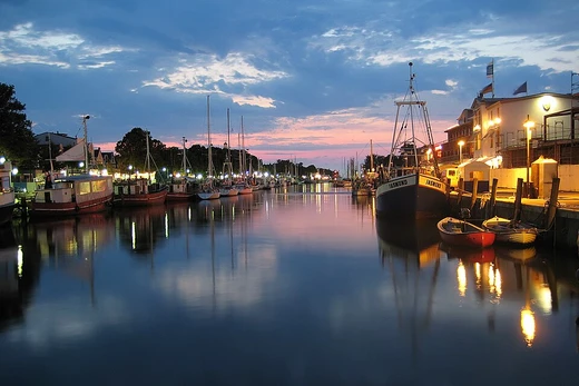
Chesapeake & Delaware Canal
Ship canal connecting Delaware River and Chesapeake Bay.

It saves approximately 300 miles on the route between Wilmington or Philadelphia on the Delaware River and Baltimore on Chesapeake Bay, avoiding a course around the Delmarva Peninsula. In the present era, the canal is owned and operated by the U.S. Army Corps of Engineers, Philadelphia District.
- Length
- 14 miles (22.5 km)
- Depth
- 35 feet (10.7 m)
- Opened
- 1829
- Owner
- U.S. Army Corps of Engineers
- Location
- Delaware and Maryland, United States
Lore & Background
In the mid-17th century, mapmaker Augustine Herman observed that the Delaware River and Chesapeake Bay were separated only by a narrow strip of land. Despite the beginnings of a commercial venture in 1802 coincident with Canal Mania in England and Wales, it was not until 1829 that the C&D Canal Company could announce the waterway 'open for business'. Its construction cost of $3.5 million made it one of the most expensive canal projects of its time. The U.S. The swampy marshlands along the canal's planned route proved a great impediment to progress.
Reader's Guide
The Chesapeake & Delaware Canal is a landmark and cultural boundary for the state of Delaware, considered a divide between the urbanized northern portion of the state and the rural southern portion, known locally as 'Lower Delaware', and demarcates an unofficial northern limit to the Delmarva Peninsula. The canal saves approximately 300 miles on the route between Wilmington or Philadelphia on the Delaware River and Baltimore on Chesapeake Bay. Its construction cost of $3.5 million made it one of the most expensive canal projects of its time. The canal is owned and operated by the U.S. Army Corps of Engineers, Philadelphia District, and the project office in Chesapeake City, Maryland, is also the site of the C&D Canal Museum and Bethel Bridge Lighthouse. The Ericsson Line operated between Baltimore and Philadelphia, carrying passengers and freight through the canal into the 1940s.
Did You Know?
- The canal saves approximately 300 miles on the route between Wilmington or Philadelphia and Baltimore.
- Its construction cost of $3.5 million made it one of the most expensive canal projects of its time.
- The canal is considered a divide between the urbanized northern portion of Delaware and the rural southern portion, known as 'Lower Delaware'.
- The Ericsson Line operated between Baltimore and Philadelphia, carrying passengers and freight through the canal into the 1940s.
The Founding Vision for Coastal Navigation
The early United States recognized that its eastern shoreline was both its national border and its primary commercial artery. With trade conducted almost entirely by water, the young government took an active interest in controlling and improving these routes. This philosophy of open, publicly funded waterways would echo through decades of policy. Treasury Secretary Albert Gallatin, responding to a Senate request, drafted a sweeping plan that identified four critical necks of land interrupting the natural tide-water route from Massachusetts to Georgia. His vision was a continuous inland passage where a vessel could travel from Boston to the Carolinas without ever facing the open ocean.
Gallatin's Blueprint and the Four Canals
He estimated the construction of four connecting canals at roughly three million dollars, embedding them within a broader twenty-million-dollar, ten-year transportation program. The four segments he identified were the Isthmus of Barnstable, the stretch of New Jersey between the Raritan and Delaware rivers, the peninsula separating the Delaware from the Chesapeake, and the marshy tract dividing the Chesapeake from Albemarle Sound. His full plan was never approved by Congress. Yet the War of 1812 and the British blockade that followed proved the strategic necessity of his thinking. In the end, all four proposed sections were built. The Cape Cod Canal still operates today, while the Delaware and Dismal Swamp segments remain integral parts of the modern Intracoastal Waterway. The Delaware and Raritan Canal, by contrast, was eventually abandoned in favor of other infrastructure.
Policy Battles and the Toll-Free Principle
The 1880s marked a pivotal moment in how Congress balanced waterway investment against the rising dominance of railroads. President Chester Arthur vetoed the measure, calling it a misuse of the government's growing budget surplus, but Congress overrode his objection.
Engineering, Maintenance, and Safe Passage
The Intracoastal Waterway spans roughly three thousand miles, threading from Massachusetts along the Atlantic seaboard, around Florida's southern tip, and up the Gulf Coast to Brownsville, Texas. Its character is mixed: some stretches are natural inlets, saltwater rivers, bays, and sounds, while others are entirely artificial canals cut through land. Throughout its length, the United States Army Corps of Engineers has been responsible for navigation improvements, maintenance, and extensive dredging where necessary. The waterway also serves as the eastern leg of the Great Loop, a waterborne circumnavigation of the eastern continental United States that requires minimal ocean exposure. By combining natural geography with engineered channels, the system offers a protected corridor for both commercial freight and recreational passage, fulfilling the strategic and economic purposes envisioned by early federal planners.
Frequently Asked Questions
What is the Chesapeake & Delaware Canal?
It is a 14-mile ship canal that links the Delaware River to the Chesapeake Bay, threading through Delaware and Maryland. Rather than forcing vessels to sail the long way around the Delmarva Peninsula, it offers a direct crossing between the two water bodies.
How much distance does the C&D Canal save compared to going around the Delmarva Peninsula?
The canal cuts roughly 300 miles off the water route between Wilmington or Philadelphia and Baltimore. That shortcut has made it a key commercial and military waterway for over two centuries.
Who owns and operates the Chesapeake & Delaware Canal today?
The U.S. Army Corps of Engineers, Philadelphia District, holds both ownership and operational responsibility for the canal. It functions as a federally maintained waterway in the present era.
More in Canals And Artificial Waterways 1-19
Spotted an error? Know more?
This is a living reference — every entry is fact-audited, and reader corrections feed straight into our audit queue. Suggest an edit · See this site's audit record