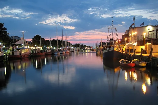
Canals of Amsterdam
Amsterdam's canal system is a planned 17th-century network of waterways.

The canals of Amsterdam, known as grachten, form a distinctive network of waterways that define the city's layout and character. Dug primarily in the 17th century during the Dutch Golden Age, the three main canals—Herengracht, Keizersgracht, and Prinsengracht—form concentric belts around the city, collectively called the Grachtengordel. This canal ring area was listed as a UNESCO World Heritage Site in 2010, contributing to Amsterdam's reputation as the 'Venice of the North.' The canal system is the result of deliberate city planning, with construction proceeding from west to east, and includes more than 100 kilometers of canals, about 90 islands, and 1,500 bridges.
- Total canal length
- More than 100 kilometers (62 mi)
- Number of islands
- About 90
- Number of bridges
- 1,500
- Main canals
- Herengracht, Keizersgracht, Prinsengracht
- UNESCO listing year
- 2010
- Monumental buildings along main canals
- 1,550
Lore & Background
Much of the Amsterdam canal system is the successful outcome of city planning. In the early part of the 17th century, with immigration rising, a comprehensive plan was put together, calling for four main, concentric half-circles of canals with their ends resting on the IJ Bay. Three of the canals are mostly for residential development: Herengracht (Patricians' Canal), Keizersgracht (Emperor's Canal), and Prinsengracht (Prince's Canal). A fourth, outer canal, the Singelgracht, was intended for defense and water management. The plan also envisaged interconnecting canals along radii, a set of parallel canals in the Jordaan quarter for goods transport, and the conversion of the existing Singel from defensive to residential and commercial use.
Reader's Guide
The canals of Amsterdam are significant for their historical role in urban planning, defense, and commerce, and for their enduring cultural and touristic value. The 17th-century canal ring area, including the Prinsengracht, Keizersgracht, Herengracht, and Jordaan, was listed as a UNESCO World Heritage Site in 2010. Today, the canals are used for tourism, recreation, houseboats, and a relatively small amount of private transport. Water quality has been a long-standing issue: through the mid-19th century the water was stagnant and unsanitary, leading to the construction of a steam-powered pump station in 1879.
Did You Know?
- Amsterdam has more than 100 kilometers of canals, about 90 islands, and 1,500 bridges.
- The three main canals—Herengracht, Keizersgracht, and Prinsengracht—were dug in the 17th century during the Dutch Golden Age.
- The canal ring area was listed as a UNESCO World Heritage Site in 2010.
Urban Waterway Networks
Canals connected within a city network represent one of two broad subdivisions of waterway canals. Amsterdam's grachten belong to this category, standing alongside the Canal Grande and other waterways of Venice, the canals of Utrecht, and the waterways of Bangkok. These urban canal systems are distinct from waterways that connect existing lakes, rivers, other canals, or seas and oceans. They serve as channels for carrying vessels that transport both goods and people through the fabric of a city. As artificial waterways, they carry free, calm surface flow under atmospheric pressure, functioning essentially as engineered rivers within an urban landscape. The grachten of Amsterdam exemplify how a city can integrate a network of navigable channels into its built environment, creating a living water infrastructure that supports daily movement and commerce at the local scale.
Engineering the Waterway
The construction of a canal like those found in Amsterdam's network involves one or more of three fundamental approaches. A canal body can be dug where no stream exists, or its sides can be formed by piling dirt, stone, concrete, or other materials into dykes and levees. The finished cross-sectional shape is called the canal prism. Where elevation changes are necessary, locks, lifts, or elevators are built to raise and lower vessels. In some cases, a channel is dredged through the bottom of an existing lake, the lake is then drained, and the channel becomes a new canal serving both drainage and transport. Alternatively, two parallel dikes can be built within a lake to form the canal between them, with the remaining water drained away. Pumping stations are required to keep surrounding land dry. These engineering demands make true canals—those cutting across drainage divides—far more difficult to construct than navigations that simply follow a river's valley.
Commerce and the Industrial Engine
Historically, canals were of immense importance to the commerce, development, growth, and vitality of a civilization. The movement of bulk raw materials such as coal and ores was practically a prerequisite for further urbanization and industrialization, yet it was difficult and only marginally affordable without water transport. Canals made this movement feasible, fueling the Industrial Revolution and spawning new research disciplines, new industries, and economies of scale that raised the standard of living across industrialized societies. In a city like Amsterdam, where the grachten form an integrated water network, these channels would have served as arteries for the goods and people that sustained urban economic life. The calm, low-speed current flow maintained by dams and locks created reliable slack water levels that allowed vessels to traverse the network with predictable efficiency, making bulk transport by water a cornerstone of commercial activity.
Decline and Enduring Legacy
The canals that once powered industrial economies have largely faded from their original purpose. In the United Kingdom, canal shipping was first augmented and then superseded by the railway system beginning in the 1840s—faster, less geographically constrained, and cheaper to maintain. By the early 1880s, many canals could no longer compete with rail. The twentieth century brought further pressure: oil replaced coal as the dominant heating fuel, and after the First World War, advances in motor trucks and expanding road networks shifted freight to the highway. Today, the few canals still in operation represent only a fraction of those maintained during the earlier Industrial Revolution. Many smaller inland waterways have been filled in, abandoned, or left to deteriorate, while others are kept in service under park services for flood control or pleasure boating. The longest extant canal, the Grand Canal in northern China at 1,794 kilometres, still sees heavy use, a reminder of what canal networks once meant to global commerce.
Frequently Asked Questions
What are the Canals of Amsterdam?
The Canals of Amsterdam, locally called grachten, are a deliberately planned network of waterways that define the city's layout and character. They consist of three concentric belts—Herengracht, Keizersgracht, and Prinsengracht—collectively known as the Grachtengordel.
When and why were the Canals of Amsterdam built?
Construction took place primarily during the Dutch Golden Age in the 17th century as part of a structured urban-planning effort. The canals were dug from west to east to create an expanding grid around the older city core.
What are the three main canals in Amsterdam?
The three principal waterways are Herengracht (innermost), Keizersgracht (middle), and Prinsengracht (outermost), which together form the Grachtengordel ring. Roughly 1,550 monumental buildings line these three main canals.
Why are the Canals of Amsterdam a UNESCO World Heritage Site?
The canal ring area received UNESCO World Heritage status in 2010 for its outstanding example of 17th-century urban planning and its ensemble of historic architecture. It reinforces Amsterdam's long-standing nickname as the 'Venice of the North.'
How large is the Amsterdam canal system?
The network stretches to more than 100 kilometers (about 62 miles) of waterways and crosses roughly 90 islands. Around 1,500 bridges span the canals, linking the various districts to one another.
More in Canals And Artificial Waterways 1-19
Spotted an error? Know more?
This is a living reference — every entry is fact-audited, and reader corrections feed straight into our audit queue. Suggest an edit · See this site's audit record