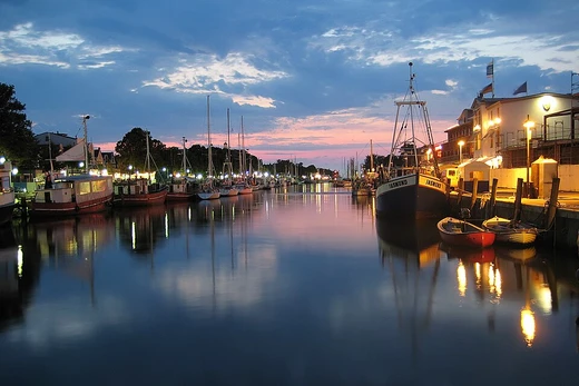
Chesapeake and Ohio Canal

It replaced the Patowmack Canal and was built to link the Eastern Seaboard to the Ohio River, though the planned western section was never completed. Its principal cargo was coal from the Allegheny Mountains.
- Elevation change
- 605 feet (184 meters)
- Number of locks
- 74
- Number of aqueducts
- 11
Lore & Background
Construction began in 1828, the same year the Patowmack Canal shut down completely. The canal was engineered to have a 2 mph water current, assisting mules pulling boats downstream. A groundbreaking ceremony was held on July 4, 1828, attended by President John Quincy Adams. The first section, from Little Falls to Seneca, opened in November 1830; the Georgetown section opened the following year. The canal reached Cumberland in 1850, eight years after the Baltimore and Ohio Railroad had already arrived there.
Reader's Guide
The Chesapeake and Ohio Canal was a major transportation artery for coal from the Allegheny Mountains, operating for nearly a century. Its construction reflected the early 19th-century competition between canals and railroads, exemplified by the dispute with the Baltimore and Ohio Railroad over the right-of-way at Point of Rocks. Although the canal never reached its intended terminus on the Ohio River, it served as a vital link between the interior and the Atlantic coast. Today, it is preserved as the Chesapeake and Ohio Canal National Historical Park, with a trail following the old towpath. The canal's history illustrates the challenges of early American infrastructure projects, including cost overruns, labor disputes, and the eventual dominance of railroads.
Did You Know?
- The canal was sometimes called the Grand Old Ditch.
- Its principal cargo was coal from the Allegheny Mountains.
- The canal had an elevation change of 605 feet, requiring 74 locks.
- A planned section to the Ohio River in Pittsburgh was never built.
Engineering & Construction Methods
Canals are constructed in three primary ways, or in combinations of all three, depending on available water sources and the terrain's path. The first method involves creating a waterway where no stream presently exists: either the canal bed is excavated, or the sides are formed by piling dirt, stone, concrete, or other building materials into dykes and levees. The finished cross-sectional shape of the channel is known as the canal prism, and the water supply must come from an external source such as streams or reservoirs. Where the new waterway must change elevation, engineering works like locks, lifts, or elevators are constructed to raise and lower vessels. The second method involves dredging a channel through the bottom of an existing lake; once complete, the lake is drained and the channel becomes a new canal serving both drainage of the surrounding polder and providing transport. The third approach builds two parallel dikes within a lake, forming the canal in between, then drains the remaining water. True canals that cut across drainage divides face greater construction difficulty and often require additional structures such as viaducts and aqueducts.
Classification & Types of Waterways
Canals are classified into two broad types. Waterways are canals and navigations used for carrying vessels that transport goods and people. These subdivide further into those connecting existing lakes, rivers, other canals, or seas and oceans, and those forming city networks such as the Canal Grande and other waterways of Venice, the grachten of Amsterdam or Utrecht, and the waterways of Bangkok. Aqueducts, by contrast, are water supply canals used for conveying and delivering potable water, municipal uses, hydroelectric power, and agricultural irrigation. Within the waterway category, a navigation is a series of channels running roughly parallel to the valley and stream bed of an unimproved river, always sharing that river's drainage basin. A vessel traverses the calm parts of the river itself alongside engineered improvements, navigating the same changes in height. A true canal, however, cuts across a drainage divide to create a navigable channel connecting two different drainage basins. Both types rely on weirs and dams to raise water levels, looping descents to bypass rapids, and locks to allow ships and barges to ascend and descend.
Industrial Importance & Gradual Decline
Historically, canals were of immense importance to the commerce, development, growth, and vitality of civilizations. The movement of bulk raw materials such as coal and ores was practically a prerequisite for further urbanization and industrialization, yet it was difficult and only marginally affordable to accomplish without water transport. Canals made this movement feasible, fueling the Industrial Revolution and spawning new research disciplines, new industries, and economies of scale that raised the standard of living for industrialized societies. Their dominance was eroded gradually. In the United Kingdom during the 1840s, canal shipping was first augmented and later superseded by the much faster, less geographically constrained, and generally cheaper-to-maintain railway system. By the early 1880s, many canals could no longer compete with rail transport and were abandoned. In the twentieth century, oil increasingly became the heating fuel of choice, and coal shipment volumes declined. After the First World War, technological advances in motor trucks combined with expanding road networks saw increasing freight moved by road, and the last small US barge canals experienced a steady decline in cargo ton-miles.
Modern Survival & Lasting Legacy
Today, the canals still in operation number only a fraction of those maintained during the earlier part of the Industrial Revolution. The once-critical smaller inland waterways, originally conceived and engineered as boat and barge canals, have largely been supplanted, filled in, abandoned, or left to deteriorate. Where they survive, many are kept in service under a park service and staffed by government employees, with dams and locks maintained for flood control or pleasure boating rather than commercial freight. Most modern ship canals, intended for larger oceangoing vessels, primarily service bulk cargo and large-ship transportation industries. The longest extant canal in the world is the Grand Canal in northern China, stretching 1,794 kilometres (1,115 miles) from Beijing to Hangzhou, with the portion south of the Yellow River still in heavy use. In a curious historical footnote, the term canal was once used to describe certain linear features on the surface of Mars, though modern imaging has revealed this to be a misnomer. Canals, in their many forms, remain a testament to human ingenuity in shaping landscapes for transport and water delivery.
Frequently Asked Questions
How many locks and aqueducts does the C&O Canal have?
The canal features 74 locks and 11 aqueducts to handle a total elevation gain of 605 feet along its route.
What cargo did the C&O Canal primarily carry?
Coal hauled out of the Allegheny Mountains was the main commodity that made the journey down the waterway to market.
More in Canals And Artificial Waterways 1-19
Spotted an error? Know more?
This is a living reference — every entry is fact-audited, and reader corrections feed straight into our audit queue. Suggest an edit · See this site's audit record